
The Welsh 3000s is a really big hike and should definitely not be taken lightly. I would like to make it clear that I am not an expert on the Welsh 3000s. I've tried running it twice, South to North, failing it both times, and I have hiked it once from North to South. I have made an impressive number of mistakes on the Welsh 3000s and can therefore give advice on how not to do it, as well as more positive advice on how to do it.
When I was planning to run the Welsh 3000s the first time (back in 2011) I was unable to find much info online about it. The main website I used for information was Welsh3000s.co.uk. As you can see, it's an old website and I found some of the route descriptions unclear (and the tiny images don't help much either). Now there are a lot of websites with information about the Welsh 3000s but they're mainly just trekking companies advertising that they lead walks along the route. There's still not all that much info out there for someone who wants to hike them independently.
So that's why I made this guide!
Now that I've done the 3000s a few times and made lots of mistakes along the way I thought I'd put together a guide. I have included everything I can think of which I'd want to read myself if I didn't know anything about the 3000s and was researching it.
If you're considering doing the Welsh 3000s then I hope that you find this section of my website to be useful.
Disclaimer: I cannot guarantee the accuracy of anything I say on here, especially the maps and routes. I've done my best to make them as accurate as I can but for goodness sake don't rely on anything I say! Are you crazy?? I make mistakes all the time! The routes are just suggestions. Do your own research and plot your routes with GPS accuracy. Stay safe out there! And if something goes wrong... don't blame me ;)
Oh and lastly, if you spot any mistakes then let me know and I'll correct them.
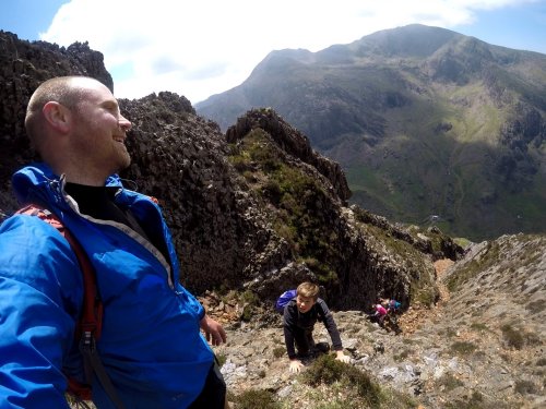
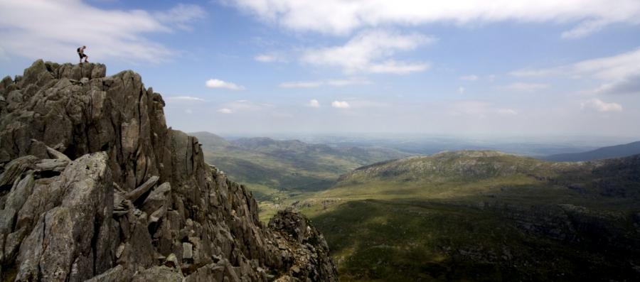
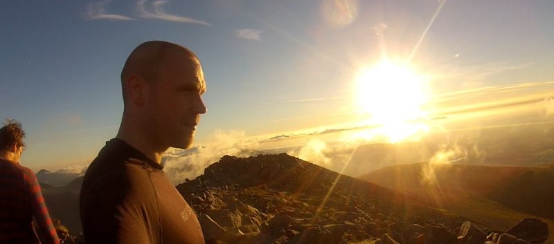
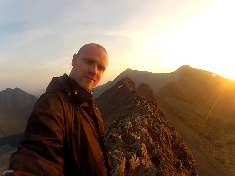
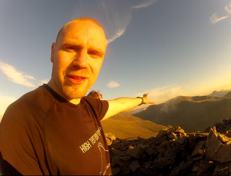
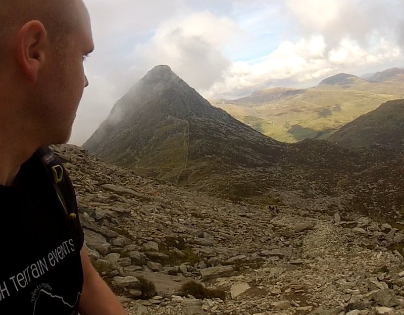
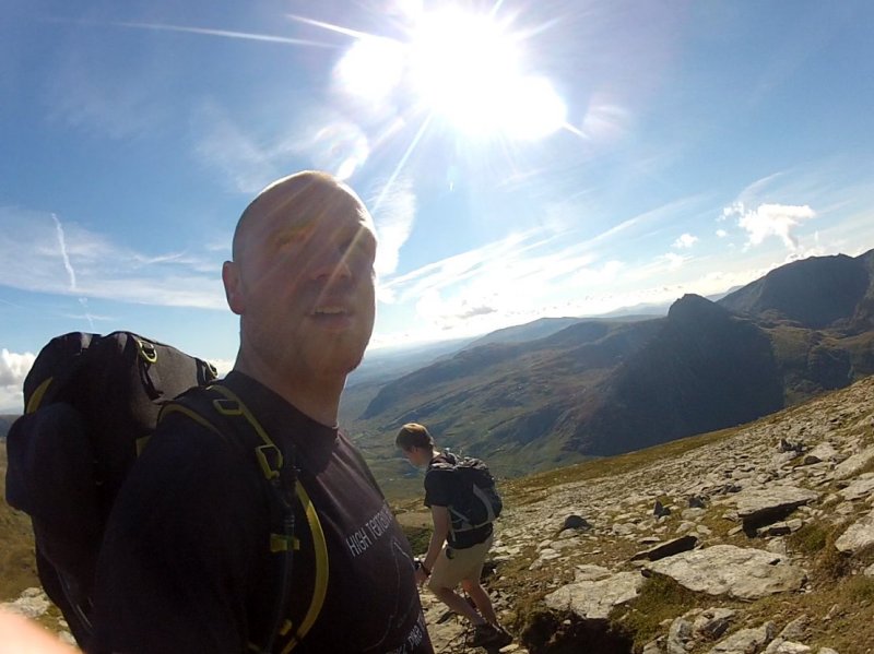
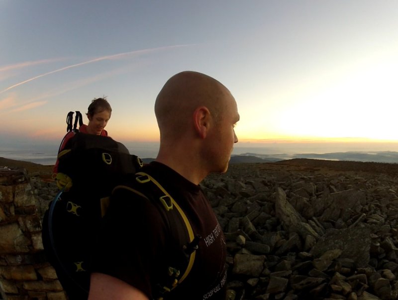
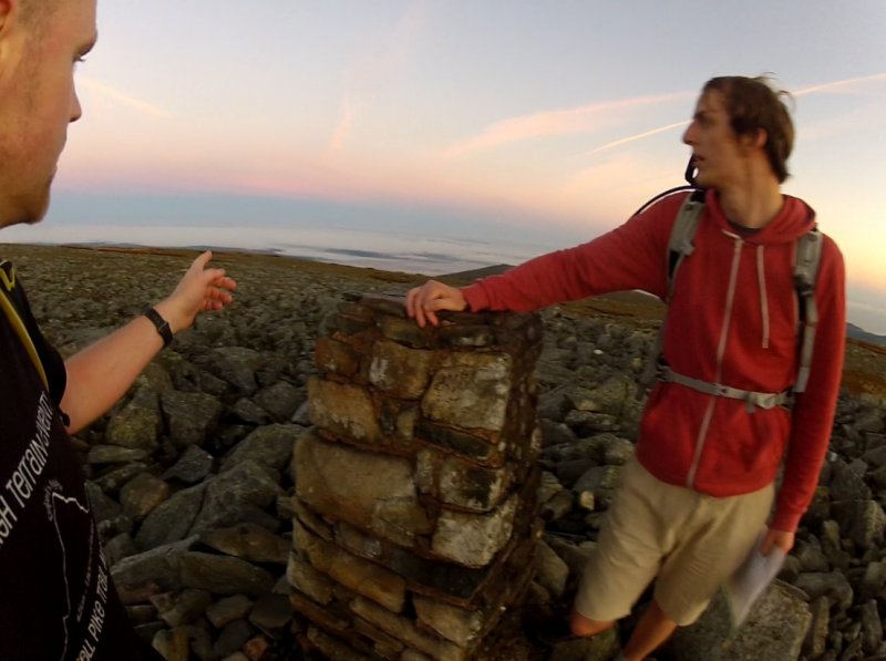
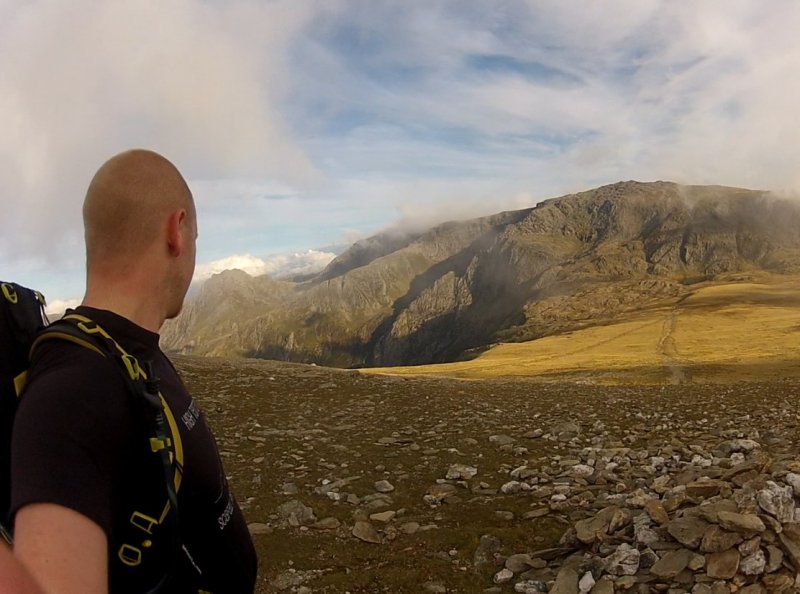
September 2015: Kev descending Pen Yr Ole Wen, with Tryfan and Glyder Fach to the right.
When I was planning to run the Welsh 3000s the first time (back in 2011) I was unable to find much info online about it. The main website I used for information was Welsh3000s.co.uk. As you can see, it's an old website and I found some of the route descriptions unclear (and the tiny images don't help much either). Now there are a lot of websites with information about the Welsh 3000s but they're mainly just trekking companies advertising that they lead walks along the route. There's still not all that much info out there for someone who wants to hike them independently.
So that's why I made this guide!
Now that I've done the 3000s a few times and made lots of mistakes along the way I thought I'd put together a guide. I have included everything I can think of which I'd want to read myself if I didn't know anything about the 3000s and was researching it.
If you're considering doing the Welsh 3000s then I hope that you find this section of my website to be useful.
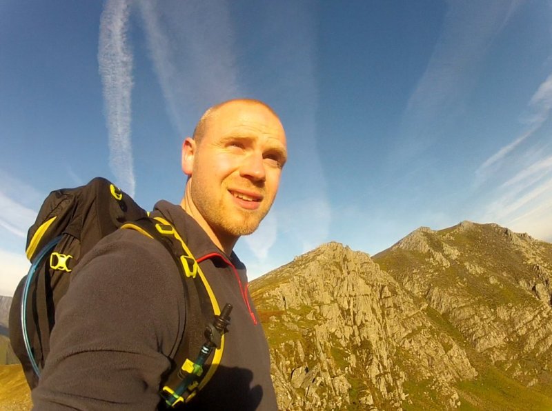
July 2010: The almighty pile of rocks that is Tryfan!
Disclaimer: I cannot guarantee the accuracy of anything I say on here, especially the maps and routes. I've done my best to make them as accurate as I can but for goodness sake don't rely on anything I say! Are you crazy?? I make mistakes all the time! The routes are just suggestions. Do your own research and plot your routes with GPS accuracy. Stay safe out there! And if something goes wrong... don't blame me ;)
Oh and lastly, if you spot any mistakes then let me know and I'll correct them.
The Welsh 3000s are the 15 highest mountains in Wales, and get their name because they're all over 3000 feet tall. The Welsh 3000s are in Snowdonia, North Wales, and are conveniently bunched up quite close together which means that it's possible to walk them all in a row.
The Welsh 3000s are also referred to as the 15 Peaks. And they're also sometimes referred to as the 14 Peaks! This is because there is a dispute over whether or not one of the summits (Carnedd Gwenllian) counts as one of the peaks. The fact is that this peak is on the way between Foel Fras and Foel Grach so it's not like it's out the way or will add any time on to your attempt so you should really touch the summit.
The Welsh 3000s Challenge is the task of touching the summit of all 15 of these mountains within 24 hours. The challenge begins at the first summit and ends at the last one and does not include the time it takes to reach the first summit or to descend from the last one. It's an unofficial challenge meaning it's not organised or anything (though of course some organisations do set up official races along the route). You can have a go at doing the Welsh 3000s whenever you want. Obviously midsummer is the best time to have a go due to longer days and (maybe) better weather.
The route is approximately 25 miles long with another 6 miles or so added for reaching the first peak and descending from the last peak. 31 miles of hiking is pretty tough at the best of times but the Welsh 3000s includes 4000m of ascent (almost half the height of Everest) and some very rough terrain. Typically the Welsh 3000s are undertaken from South to North, starting at the summit of Snowdon and finishing at the summit of Foel Fras.
1) Snowdon
2) Garnedd Ugain
3) Crib Goch
4) Elidir Fawr
5) Y Garn
6) Glyder Fawr
7) Glyder Fach
8) Tryfan (not technically one of the Glyders but joined to them)
9) Pen Yr Ole Wen
10) Carnedd Dafydd
11) Carnedd Llewellyn
12) Yr Elen
13) Foel Grach
14) Carnedd Gwenllian
15) Foel Fras

The Welsh 3000s are also referred to as the 15 Peaks. And they're also sometimes referred to as the 14 Peaks! This is because there is a dispute over whether or not one of the summits (Carnedd Gwenllian) counts as one of the peaks. The fact is that this peak is on the way between Foel Fras and Foel Grach so it's not like it's out the way or will add any time on to your attempt so you should really touch the summit.
The Welsh 3000s Challenge / 15 Peak Challenge
The Welsh 3000s Challenge is the task of touching the summit of all 15 of these mountains within 24 hours. The challenge begins at the first summit and ends at the last one and does not include the time it takes to reach the first summit or to descend from the last one. It's an unofficial challenge meaning it's not organised or anything (though of course some organisations do set up official races along the route). You can have a go at doing the Welsh 3000s whenever you want. Obviously midsummer is the best time to have a go due to longer days and (maybe) better weather.
The route is approximately 25 miles long with another 6 miles or so added for reaching the first peak and descending from the last peak. 31 miles of hiking is pretty tough at the best of times but the Welsh 3000s includes 4000m of ascent (almost half the height of Everest) and some very rough terrain. Typically the Welsh 3000s are undertaken from South to North, starting at the summit of Snowdon and finishing at the summit of Foel Fras.
September 2015: Approaching the summit of Elidir Fawr as the sun begins to set.
The 15 Mountains Of The Welsh 3000s (South to North)
The Snowdon Group
1) Snowdon
2) Garnedd Ugain
3) Crib Goch
The Glyders
4) Elidir Fawr
5) Y Garn
6) Glyder Fawr
7) Glyder Fach
8) Tryfan (not technically one of the Glyders but joined to them)
The Carneddau
9) Pen Yr Ole Wen
10) Carnedd Dafydd
11) Carnedd Llewellyn
12) Yr Elen
13) Foel Grach
14) Carnedd Gwenllian
15) Foel Fras
So far I've attempted the Welsh 3000s 3 times.
Despite having climbed Snowdon a load of times throughout my life I didn't even learn what the Welsh 3000s was until July 2010. That summer I started seeing a girl and she was in the process of training for the 3000s, going to Snowdonia every weekend or so to practice different parts of the route. That's when I decided I wanted to do it sometime as well.
I'd broken my right ankle in May (from jumping into a ditch during a mud run) which sucked because it meant I spent the whole summer in a cast, unable to do much. During this time I spent ages online, planning loads of cool things for when I was able to move again. One of those things was to run the Welsh 3000s. I looked up the (very limited) info available online and plotted out the route (as best as I could) on Google Maps. I then used a trial version of the Maps editor to make a fly-through video of the route.
Click here to watch the video (Please excuse my non-attempts at pronouncing the names of each mountain)
With great determination but incredible naivety I tried to run the Welsh 3000s by myself and unsupported, from South to North, pulling out half way at Tryfan due to injury (my right ankle was still stiff and weak) and bad weather.
Click here to watch the video
Marginally better prepared than last time I tried to run it by myself unsupported from South to North again, pulling out half way at Tryfan due to injury again (my right knee stopped working and my left bollock felt like it was trapped in a vice).
Click here to watch the video
This time I decided to hike it rather than run it, North to South, and with another person. We managed the whole thing except for Garnedd Ugain and Crib Goch due to safety issues. Despite not getting those two peaks we hiked the full distance (31 miles) plus an extra two miles to get back to the car, so as far as I'm concerned we completed the Welsh 3000s.
Click here to watch the video
On each of my three attempts I made a number of mistakes. On the next page I'll explain what they were so that hopefully you don't do the same.
Hoorah! I've finally done them. Haha.
Click here to watch the video
Despite having climbed Snowdon a load of times throughout my life I didn't even learn what the Welsh 3000s was until July 2010. That summer I started seeing a girl and she was in the process of training for the 3000s, going to Snowdonia every weekend or so to practice different parts of the route. That's when I decided I wanted to do it sometime as well.
Planning: June 2011
I'd broken my right ankle in May (from jumping into a ditch during a mud run) which sucked because it meant I spent the whole summer in a cast, unable to do much. During this time I spent ages online, planning loads of cool things for when I was able to move again. One of those things was to run the Welsh 3000s. I looked up the (very limited) info available online and plotted out the route (as best as I could) on Google Maps. I then used a trial version of the Maps editor to make a fly-through video of the route.
Click here to watch the video (Please excuse my non-attempts at pronouncing the names of each mountain)
Attempt 1: October 2011
With great determination but incredible naivety I tried to run the Welsh 3000s by myself and unsupported, from South to North, pulling out half way at Tryfan due to injury (my right ankle was still stiff and weak) and bad weather.
Click here to watch the video
Attempt 2: July 2012
Marginally better prepared than last time I tried to run it by myself unsupported from South to North again, pulling out half way at Tryfan due to injury again (my right knee stopped working and my left bollock felt like it was trapped in a vice).
Click here to watch the video
Attempt 3: September 2015
This time I decided to hike it rather than run it, North to South, and with another person. We managed the whole thing except for Garnedd Ugain and Crib Goch due to safety issues. Despite not getting those two peaks we hiked the full distance (31 miles) plus an extra two miles to get back to the car, so as far as I'm concerned we completed the Welsh 3000s.
Click here to watch the video
On each of my three attempts I made a number of mistakes. On the next page I'll explain what they were so that hopefully you don't do the same.
UPDATE: July 2018
Hoorah! I've finally done them. Haha.
Click here to watch the video
When it comes to what not to do on the Welsh 3000s I'm quite the expert. Thanks to my habit of just throwing myself into situations without much planning or preparation I have a unique insight into the consequences of doing really dumb things.
On the plus side this means that I can tell you what to do and what to avoid so that you don't make the same stupid mistakes that I did.
Here's how to maximise your chances of Welsh 3000s success:
When I say that the Welsh 3000s is a tough hike I'm not kidding. Some walks are described as tough but are in fact perfectly manageable by anyone with decent fitness and a bit of hill walking experience (for example, the National 3 Peaks). The Welsh 3000s is not for anyone who doesn't fully understand what they're putting themselves in for. If you're not mountain strong then you're going to have a bad time on the Welsh 3000s. You need to be conditioned for long hard slogs up and down multiple rough mountains otherwise before you even get half way you'll find yourself exhausted and probably injured too.
The first two times I attempted the Welsh 3000s I tried to run them. I did this without having done any previous training. I was in relatively good shape and had run mountains and marathons before, but never a mountain marathon (which is what the 3000s basically is). Not only was it a 25 mile mountain run but I also drove 170 miles to Snowdon and then climbed up Snowdon in the dark before immediately starting the run. This meant that from the moment I started the clock my muscles were already a bit tired as I'd had no rest for an entire day and night beforehand. Doing the 3000s without having had any rest is not a good idea. In fact it's a terrible idea! And I did it twice, resulting in me dropping out before Tryfan because I'd run out of energy (the first time) and was injured (the second time). If your body isn't used to walking or running on hard, rugged, steep ground whilst carrying a backpack then you're almost certainly going to end up pulling a muscle or ligament or something so make sure you condition yourself well.
Yes, it seems kind of obvious doesn't it. However, on my first 3000s attempt I rocked up to Snowdon with barely a clue about the route ahead of me. I had only ever climbed the Snowdon group and Tryfan in the past. All of the other mountains were completely new to me so I couldn't visualise what they were like. There's only so much info you can get from a map. In order to know your route properly you need to have done it before. 12 of the 15 mountains ahead of me were a mystery (I include Tryfan because I'd only done it once before and not from the direction this run would take me). I didn't know how steep they were, what the terrain would be like or even what the summits looked like (some of the mountains do not have very obvious summits at all).
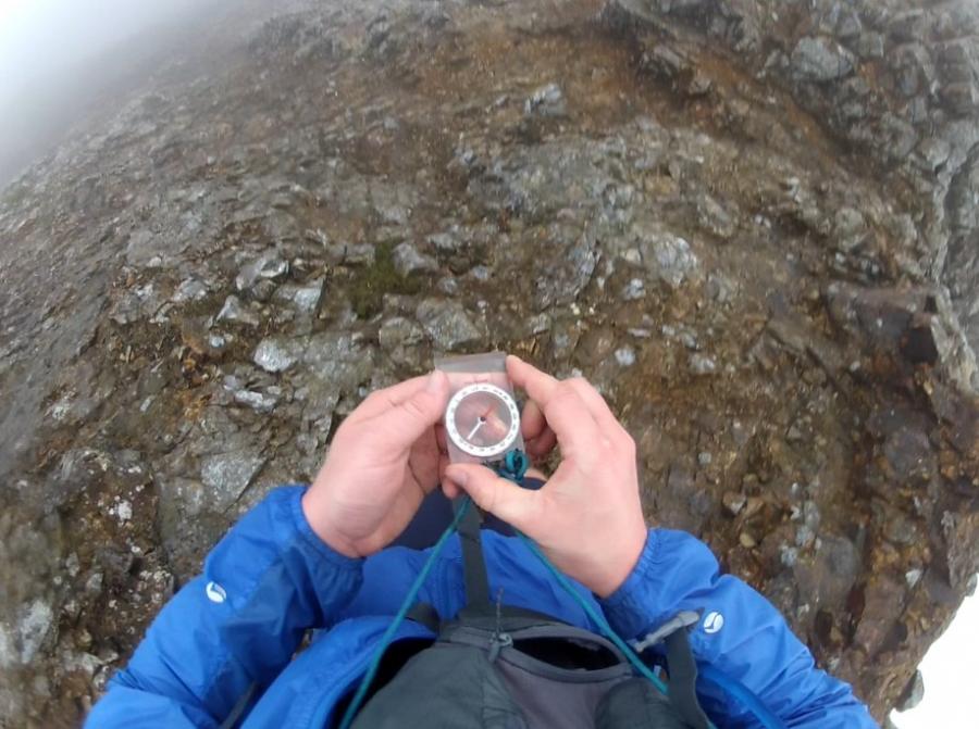
On a glorious, sunny day it's not so important to know the routes well because when the path seems to vanish you can spot where it starts up again further ahead. However, when the mist comes down then you suddenly realise how useful it is to be familiar with a route beforehand. Yes, a map and compass are essential but it makes things 10x easier if you also recognise the route that you're on because you've been there before, rather than just going by the map and hoping for the best.
On my first attempt I managed to mess up several times due to it being foggy. I'd done Crib Goch loads of times before but never West to East and I got disorientated in the fog leading to me climbing down the wrong way at one point and then having to go back on myself. Then at the base of Elidir Fawr I got stupidly lost and ended up pushing my way through undergrowth for half an hour rather than walking on the clearly marked path on the other side of the stream. The route to Elidr Fawr's main track is really not that obvious and I was relying on a description of it from a website I found rather than it being clearly marked on my map (for some annoying reason it's not marked on OS maps). Lastly I got lost in the fog somewhere up Glyder Fawr for the best part of an hour. This was extremely frustrating and I felt my energy sapping away as I faffed around on a rocky slope, constantly moving towards what looked to be a path only to realise it wasn't.
On my second attempt I wasted it a bit of time coming down off of Crib Goch because I'd never descended the North Ridge before and it was misty (again). This led to me zigzagging around for a bit rather than coming down the most efficient route (which I'm pleased to say that I am now very familiar with). Even though it wasn't misty at the base of Elidir Fawr I still managed to get briefly lost when trying to find the track that goes up it (having not got it right last time I still didn't know where it was). And then after Elidir Fawr I made a spectacular error and ended up climbing the very steep Northern scree slope of Foel Goch which isn't even one of the 3000s! What a total idiot.
Getting lost and going the wrong way doesn't just waste precious time and energy, it also lowers your morale. It's a pretty crappy feeling when you have to go back on yourself because of a stupid mistake and you still have so very far to go. A quick check of the map and I'd have seen that I was supposed to run around Foel Goch, not over it, saving me a whole load of energy. Always keep your map handy and make sure you regularly check it!
25 miles is a really long way and no matter how confident and full of energy you feel at the start you have to make sure that you don't go in guns blazing. You might power through the first 5 miles and be feeling pretty good but you still have 20 miles to go (plus whatever the distance is off of the mountains). When muscle fatigue starts to set in and you're not even half way then you're going to be feeling pretty damn awful.
With my first two attempts I set off far too hard. I was excited about doing the run and because I was so familiar with the Snowdon group I felt like I should be hammering over it to get it out the way. This is the equivalent of sprinting at the start of a marathon and is not the way to do it! Make sure you move at a comfortable pace. No matter how strong you feel at the start you have to remember that there are some seriously steep slopes ahead of you which will really take it out of your legs when you get to them. Keep it steady and your chances of finishing (and not getting injured along the way) will be much better.
Unless you're seriously hardcore and are moving at speed the whole way then the chances are that you're going to spend a portion of your hike in the dark. It might seem so obvious but I'll still say it:
Light is absolutely essential on a walk like this!
In fact light is essential on any walk, even if you don't plan to be out in the dark. You never know what might happen which causes you to still be out on the hills as night falls and you really do not want to be in a situation where you need light but haven't got any. Packing a good quality head torch is great but what if the batteries run out? What if you drop it off a cliff or it breaks? Up in the mountains of the Welsh 3000s something like that could quickly turn from annoying and inconvenient to life threatening.
Pack a head torch with fresh batteries, a spare set of batteries in an easy-to-reach pocket and a second torch, also with fresh batteries. If you're in a group then ideally you want everyone to each have two torches and spare batteries.
Light is something which is so easy to take for granted but next time you're walking in the mountains at night and it's cloudy and there's no moon then you should turn your lights off and imagine you then had to make your way back to the car. The world becomes a very scary place in the pitch black and on a mountain there are numerous ways for you to get injured or killed when stumbling about aimlessly.
On my first attempt I had a really crap head torch. I was ridiculously under-kitted for what was ahead of me. Fortunately I had to drop out before it got dark which is the best thing that I could have done given the circumstances.
On my second attempt I had adequate light (head torch, spare batteries and a secondary wind-up torch in case I had to change my head torch's batteries in the dark). Yay! Go me!
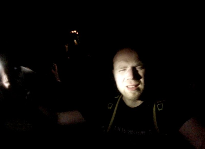
On my third attempt I had my head torch, my wind-up torch and my mega-light which had the brightness of one thousand suns. However I made the schoolboy error of not putting fresh batteries into my head torch which was pretty dull the entire time I used it which made it awkward to hike along rocky ground and almost useless at spotting things in the distance and path-finding. Due to it being September Kev and I were walking in the dark for a total of 8 hours! This is plenty of time for a torch to fade and die, even if it seems really bright at the start.
The mega light was great whilst it lasted but half way down the Pyg Track it ran out of power! So suddenly Kev and I went from a super-beam which lit up 100m ahead of us down to a couple of dull head torches. The mega-light had been invaluable to us for finding the path and without it our descent slowed right down and we even got lost at one point which was as ridiculous as it was frustrating. So the mistake we made was relying too much on the mega light and not having a spare battery for it. It gave no warning that it was running out of power. It just stopped working. Scary stuff! (made even more scary by the thought that we could have been up Crib Goch when it happened, rather than on the relatively easy Pyg Track).
The Welsh 3000s route crosses two main roads along the way. These are the A4086 between the Snowdon group and the Glyders, and the A5, between the Glyders/Tryfan and the Carneddau range. If you're lucky enough to have a support team then they can meet you along these two roads in order to give you food and water and take any excess kit from you (for example, if you'd camped up Snowdon and were carrying a tent).
If you're doing the hike by yourself or in a group without support then you can help yourself out by leaving supplies in strategic locations before you start the walk so that you can collect it later on. It takes a bit of planning and requires more time and effort but it's well worth it. The fact is that the Welsh 3000s takes a lot of energy and if you carry all of your food and drink on you at all times then your backpack is going to be extremely heavy.
On my first two attempts I didn't have any supplies waiting for me along the route. I was carrying everything on my back and as a consequence I'm sure that I wouldn't have had enough. "Fortunately" I had to drop out about half way round so I didn't go long enough to run out of food and drink.
On the third attempt I definitely did not pack enough food or water. It was another schoolboy error (I really need to stop making those!) Luckily Kev was much more sensible and had brought a lot of food and sweets and isotonic drinks and water and had planted resupply packages, one in Nant Peris and the other at the base of Tryfan's North ridge. Big respect to Kev because without his foresight we'd have both been screwed.
Another obvious one, yet it's still something I never seem to be able to do. Whether it's the Welsh 3000s or the National 3 Peaks, I just don't sleep the night before! When you have a 24 hour challenge ahead of you it really doesn't help anything if you've been awake for 24 hours already.
Mental tiredness isn't just uncomfortable, it's dangerous. The more tired you are, the more mistakes you're likely to make and when you're up a mountain in the dark you don't want to be making mistakes.
On my third attempt Kev and I were hiking for 22 hours and by the end had been awake for close to 2 days because we'd not got any sleep before starting the walk at 4am. During the day we felt fine but when it got dark and we started a very tough route up Snowdon then things deteriorated quickly. Every time we stopped the only thing I wanted to do was curl up and go to sleep yet we were many miles from finishing and being safely back at the car. It made everything feel like it was 10x harder. I can easily stay awake for 24 hours but 48 hours is really pushing it, especially with so much physical exertion needed during that time.
Get as much sleep as you can before starting the Welsh 3000s!
I hope that this advice has been of some use to you! I'll almost certainly do the Welsh 3000s again sometime and when I do I'll inevitably make some really dumb mistakes after which I'll update this page so that you can learn from my foolishness. Stay safe out there, kids!
On the plus side this means that I can tell you what to do and what to avoid so that you don't make the same stupid mistakes that I did.
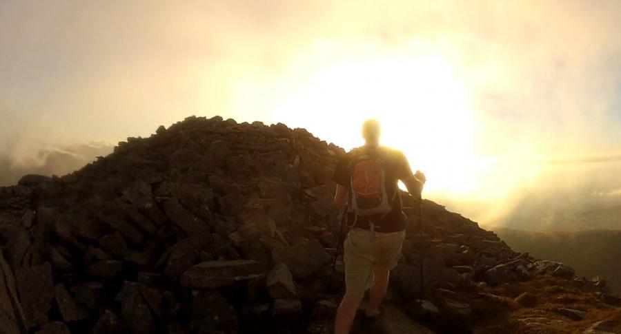
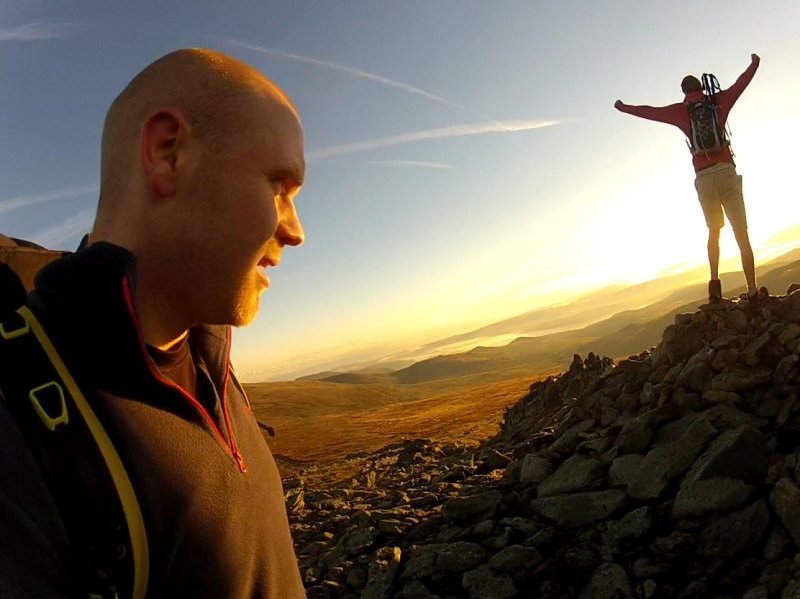
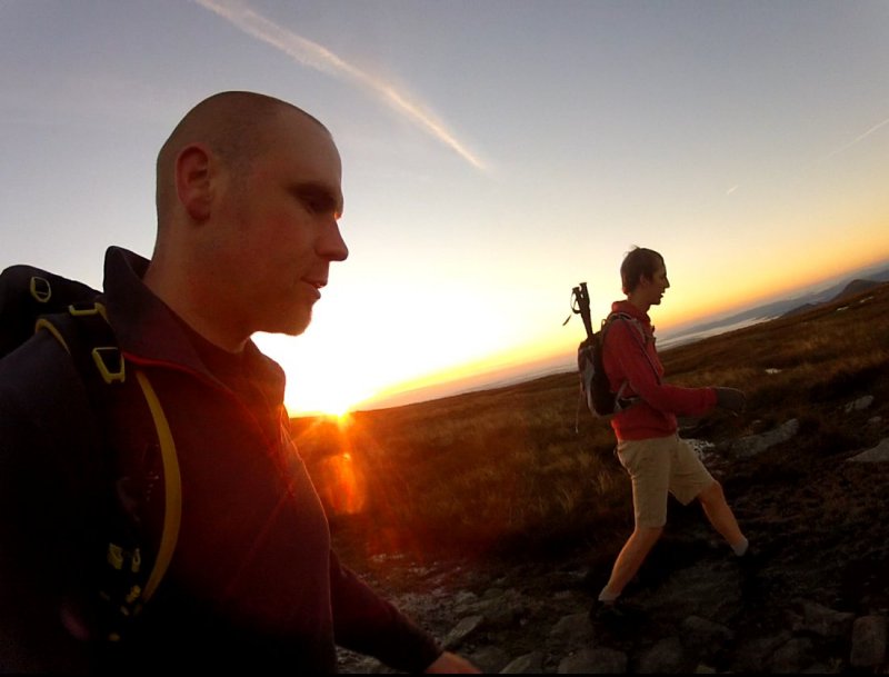
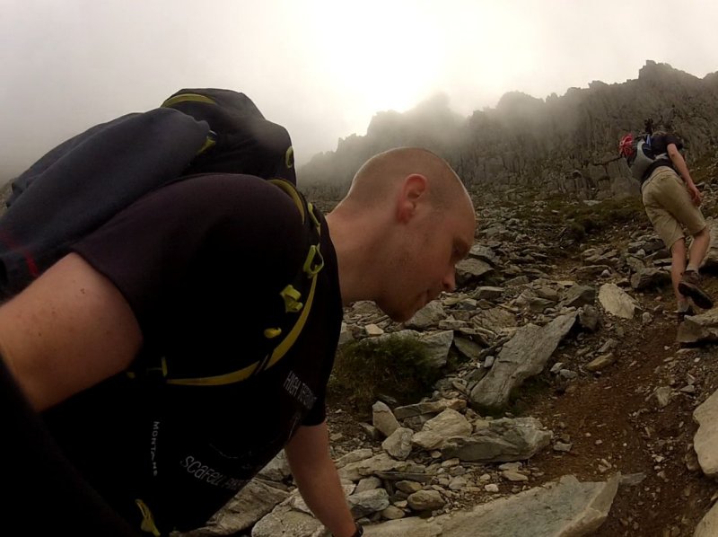
Attempt 3: September 2015: Only 10 more summits to go...
Here's how to maximise your chances of Welsh 3000s success:
Train for it
When I say that the Welsh 3000s is a tough hike I'm not kidding. Some walks are described as tough but are in fact perfectly manageable by anyone with decent fitness and a bit of hill walking experience (for example, the National 3 Peaks). The Welsh 3000s is not for anyone who doesn't fully understand what they're putting themselves in for. If you're not mountain strong then you're going to have a bad time on the Welsh 3000s. You need to be conditioned for long hard slogs up and down multiple rough mountains otherwise before you even get half way you'll find yourself exhausted and probably injured too.
The first two times I attempted the Welsh 3000s I tried to run them. I did this without having done any previous training. I was in relatively good shape and had run mountains and marathons before, but never a mountain marathon (which is what the 3000s basically is). Not only was it a 25 mile mountain run but I also drove 170 miles to Snowdon and then climbed up Snowdon in the dark before immediately starting the run. This meant that from the moment I started the clock my muscles were already a bit tired as I'd had no rest for an entire day and night beforehand. Doing the 3000s without having had any rest is not a good idea. In fact it's a terrible idea! And I did it twice, resulting in me dropping out before Tryfan because I'd run out of energy (the first time) and was injured (the second time). If your body isn't used to walking or running on hard, rugged, steep ground whilst carrying a backpack then you're almost certainly going to end up pulling a muscle or ligament or something so make sure you condition yourself well.
Attempt 3: September 2015: Heading down the very steep and rough slope of Glyder Fawr towards Y Garn.
Know the route and check your map
Yes, it seems kind of obvious doesn't it. However, on my first 3000s attempt I rocked up to Snowdon with barely a clue about the route ahead of me. I had only ever climbed the Snowdon group and Tryfan in the past. All of the other mountains were completely new to me so I couldn't visualise what they were like. There's only so much info you can get from a map. In order to know your route properly you need to have done it before. 12 of the 15 mountains ahead of me were a mystery (I include Tryfan because I'd only done it once before and not from the direction this run would take me). I didn't know how steep they were, what the terrain would be like or even what the summits looked like (some of the mountains do not have very obvious summits at all).
On a glorious, sunny day it's not so important to know the routes well because when the path seems to vanish you can spot where it starts up again further ahead. However, when the mist comes down then you suddenly realise how useful it is to be familiar with a route beforehand. Yes, a map and compass are essential but it makes things 10x easier if you also recognise the route that you're on because you've been there before, rather than just going by the map and hoping for the best.
On my first attempt I managed to mess up several times due to it being foggy. I'd done Crib Goch loads of times before but never West to East and I got disorientated in the fog leading to me climbing down the wrong way at one point and then having to go back on myself. Then at the base of Elidir Fawr I got stupidly lost and ended up pushing my way through undergrowth for half an hour rather than walking on the clearly marked path on the other side of the stream. The route to Elidr Fawr's main track is really not that obvious and I was relying on a description of it from a website I found rather than it being clearly marked on my map (for some annoying reason it's not marked on OS maps). Lastly I got lost in the fog somewhere up Glyder Fawr for the best part of an hour. This was extremely frustrating and I felt my energy sapping away as I faffed around on a rocky slope, constantly moving towards what looked to be a path only to realise it wasn't.
On my second attempt I wasted it a bit of time coming down off of Crib Goch because I'd never descended the North Ridge before and it was misty (again). This led to me zigzagging around for a bit rather than coming down the most efficient route (which I'm pleased to say that I am now very familiar with). Even though it wasn't misty at the base of Elidir Fawr I still managed to get briefly lost when trying to find the track that goes up it (having not got it right last time I still didn't know where it was). And then after Elidir Fawr I made a spectacular error and ended up climbing the very steep Northern scree slope of Foel Goch which isn't even one of the 3000s! What a total idiot.
Getting lost and going the wrong way doesn't just waste precious time and energy, it also lowers your morale. It's a pretty crappy feeling when you have to go back on yourself because of a stupid mistake and you still have so very far to go. A quick check of the map and I'd have seen that I was supposed to run around Foel Goch, not over it, saving me a whole load of energy. Always keep your map handy and make sure you regularly check it!
Attempt 2: July 2012: Heading down the North ridge of Crib Goch for the first time in my life. Funnily enough it turns out that I didn't need to slide down that very steep slope covered in sharp rocks after all. Who'd have guessed it!
Pace Yourself
25 miles is a really long way and no matter how confident and full of energy you feel at the start you have to make sure that you don't go in guns blazing. You might power through the first 5 miles and be feeling pretty good but you still have 20 miles to go (plus whatever the distance is off of the mountains). When muscle fatigue starts to set in and you're not even half way then you're going to be feeling pretty damn awful.
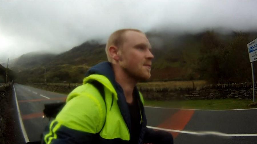
With my first two attempts I set off far too hard. I was excited about doing the run and because I was so familiar with the Snowdon group I felt like I should be hammering over it to get it out the way. This is the equivalent of sprinting at the start of a marathon and is not the way to do it! Make sure you move at a comfortable pace. No matter how strong you feel at the start you have to remember that there are some seriously steep slopes ahead of you which will really take it out of your legs when you get to them. Keep it steady and your chances of finishing (and not getting injured along the way) will be much better.
Attempt 1: October 2011: Slow down, Dave! You've got a long way to go yet! Running along the A4086 towards Elidir Fawr.
Take lots of light
Unless you're seriously hardcore and are moving at speed the whole way then the chances are that you're going to spend a portion of your hike in the dark. It might seem so obvious but I'll still say it:
Light is absolutely essential on a walk like this!
In fact light is essential on any walk, even if you don't plan to be out in the dark. You never know what might happen which causes you to still be out on the hills as night falls and you really do not want to be in a situation where you need light but haven't got any. Packing a good quality head torch is great but what if the batteries run out? What if you drop it off a cliff or it breaks? Up in the mountains of the Welsh 3000s something like that could quickly turn from annoying and inconvenient to life threatening.
Pack a head torch with fresh batteries, a spare set of batteries in an easy-to-reach pocket and a second torch, also with fresh batteries. If you're in a group then ideally you want everyone to each have two torches and spare batteries.
Light is something which is so easy to take for granted but next time you're walking in the mountains at night and it's cloudy and there's no moon then you should turn your lights off and imagine you then had to make your way back to the car. The world becomes a very scary place in the pitch black and on a mountain there are numerous ways for you to get injured or killed when stumbling about aimlessly.
On my first attempt I had a really crap head torch. I was ridiculously under-kitted for what was ahead of me. Fortunately I had to drop out before it got dark which is the best thing that I could have done given the circumstances.
On my second attempt I had adequate light (head torch, spare batteries and a secondary wind-up torch in case I had to change my head torch's batteries in the dark). Yay! Go me!
On my third attempt I had my head torch, my wind-up torch and my mega-light which had the brightness of one thousand suns. However I made the schoolboy error of not putting fresh batteries into my head torch which was pretty dull the entire time I used it which made it awkward to hike along rocky ground and almost useless at spotting things in the distance and path-finding. Due to it being September Kev and I were walking in the dark for a total of 8 hours! This is plenty of time for a torch to fade and die, even if it seems really bright at the start.
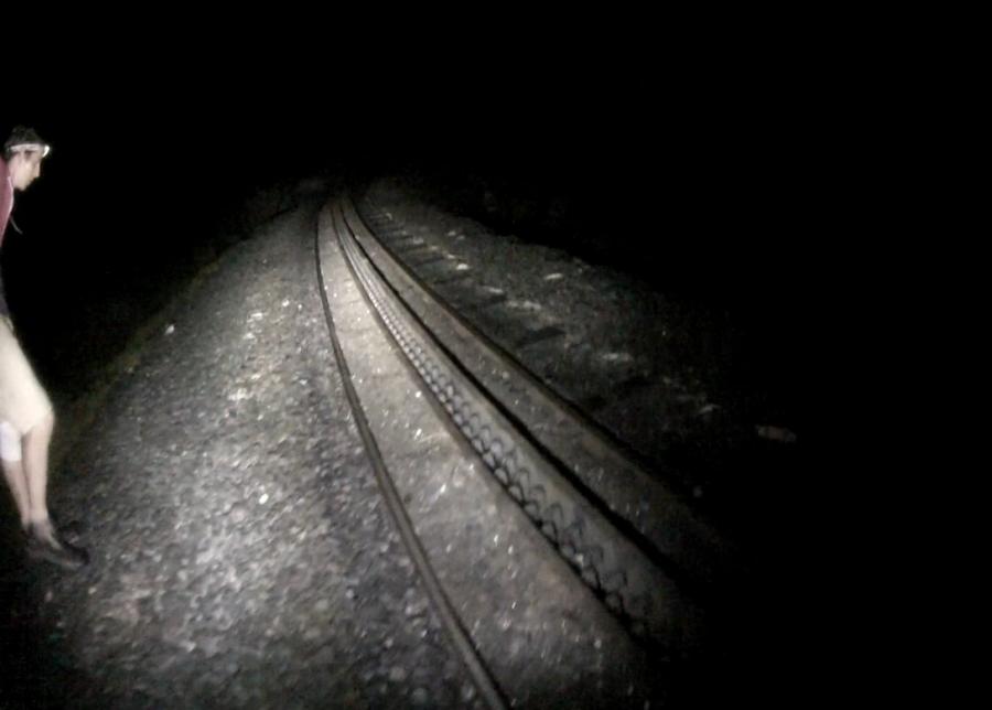
The mega light was great whilst it lasted but half way down the Pyg Track it ran out of power! So suddenly Kev and I went from a super-beam which lit up 100m ahead of us down to a couple of dull head torches. The mega-light had been invaluable to us for finding the path and without it our descent slowed right down and we even got lost at one point which was as ridiculous as it was frustrating. So the mistake we made was relying too much on the mega light and not having a spare battery for it. It gave no warning that it was running out of power. It just stopped working. Scary stuff! (made even more scary by the thought that we could have been up Crib Goch when it happened, rather than on the relatively easy Pyg Track).
Attempt 3: September 2015: The mega-light showing the way when we reached the railway track. When this ran out of power later on we realised how bad our head torches actually were.
Carry loads of food and water and stash even more along the route
The Welsh 3000s route crosses two main roads along the way. These are the A4086 between the Snowdon group and the Glyders, and the A5, between the Glyders/Tryfan and the Carneddau range. If you're lucky enough to have a support team then they can meet you along these two roads in order to give you food and water and take any excess kit from you (for example, if you'd camped up Snowdon and were carrying a tent).
If you're doing the hike by yourself or in a group without support then you can help yourself out by leaving supplies in strategic locations before you start the walk so that you can collect it later on. It takes a bit of planning and requires more time and effort but it's well worth it. The fact is that the Welsh 3000s takes a lot of energy and if you carry all of your food and drink on you at all times then your backpack is going to be extremely heavy.
On my first two attempts I didn't have any supplies waiting for me along the route. I was carrying everything on my back and as a consequence I'm sure that I wouldn't have had enough. "Fortunately" I had to drop out about half way round so I didn't go long enough to run out of food and drink.
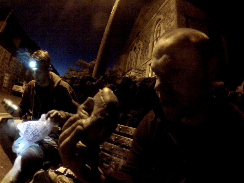
On the third attempt I definitely did not pack enough food or water. It was another schoolboy error (I really need to stop making those!) Luckily Kev was much more sensible and had brought a lot of food and sweets and isotonic drinks and water and had planted resupply packages, one in Nant Peris and the other at the base of Tryfan's North ridge. Big respect to Kev because without his foresight we'd have both been screwed.
Attempt 3: September 2015: Refuelling on a bench in Nant Peris, courtesy of Kev's care-package he'd stashed behind a wall.
Get some proper sleep beforehand!
Another obvious one, yet it's still something I never seem to be able to do. Whether it's the Welsh 3000s or the National 3 Peaks, I just don't sleep the night before! When you have a 24 hour challenge ahead of you it really doesn't help anything if you've been awake for 24 hours already.
Mental tiredness isn't just uncomfortable, it's dangerous. The more tired you are, the more mistakes you're likely to make and when you're up a mountain in the dark you don't want to be making mistakes.
On my third attempt Kev and I were hiking for 22 hours and by the end had been awake for close to 2 days because we'd not got any sleep before starting the walk at 4am. During the day we felt fine but when it got dark and we started a very tough route up Snowdon then things deteriorated quickly. Every time we stopped the only thing I wanted to do was curl up and go to sleep yet we were many miles from finishing and being safely back at the car. It made everything feel like it was 10x harder. I can easily stay awake for 24 hours but 48 hours is really pushing it, especially with so much physical exertion needed during that time.
Get as much sleep as you can before starting the Welsh 3000s!
Attempt 3: September 2015: On our way up Snowdon, 7 miles to go until we're back at the car, really starting to feel the effects of having been awake for 40 hours.
I hope that this advice has been of some use to you! I'll almost certainly do the Welsh 3000s again sometime and when I do I'll inevitably make some really dumb mistakes after which I'll update this page so that you can learn from my foolishness. Stay safe out there, kids!
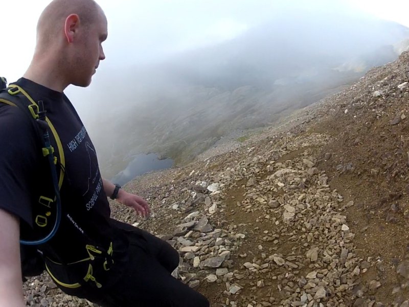
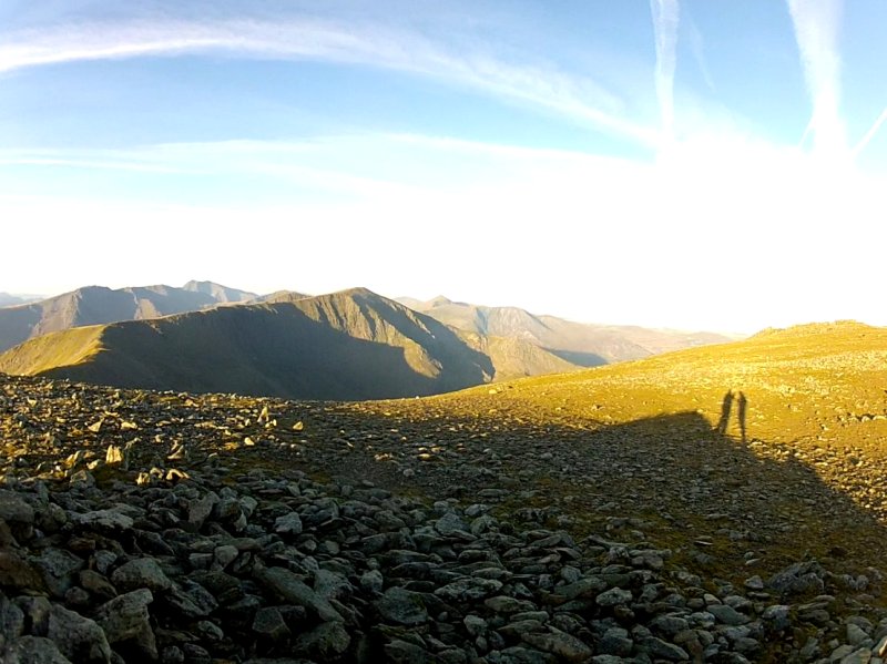
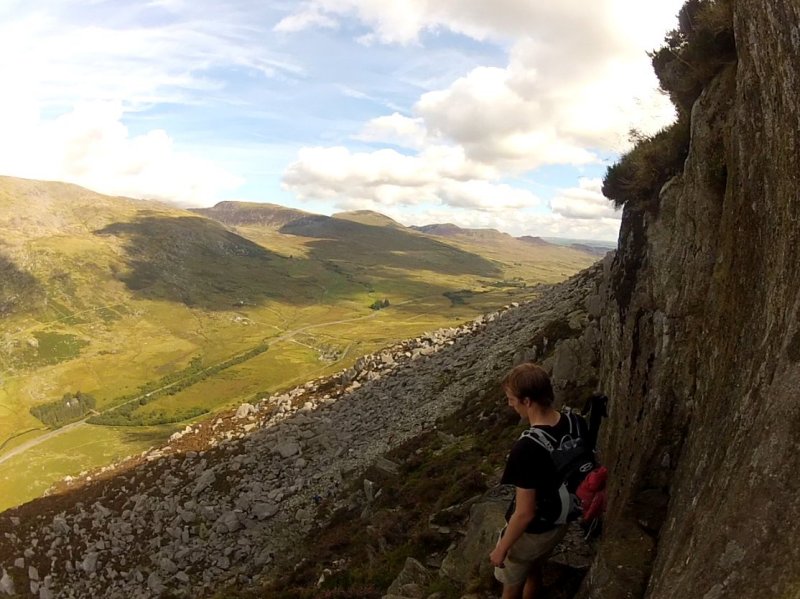
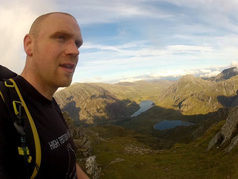
Attempt 3: September 2015: Checking out the view from Elidir Fawr as the sun begins to set.
South to North is the usual direction by which people do the Welsh 3000s because it ends on the Carneddau range which is easy compared to the other mountains. The final peak, Foel Fras, might be several miles from the nearest car park but it is simple to get down from (much more so than Snowdon if you did the 3000s from North to South).
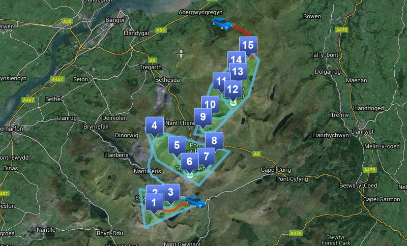
Click here to open a map of the route in a new window.
Most people attempting the Welsh 3000s start at Snowdon and then tag Garnedd Ugain and Crib Goch before descending off of Crib Goch's North ridge. The two times I tried to run the 3000s I climbed to the top of Snowdon at night, up the Pyg Track, timing it so that I would summit as it was beginning to get light. This meant that I had the maximum amount of daylight to work with.
Climbing Snowdon is no simple task and takes a fair amount of energy, and that's all before you've even started the clock for doing the 3000s! Because of this people sometimes climb Snowdon the night before and then camp or bivvy near the top before setting off the next morning. This means that their muscles get some rest before starting. Of course, it also means you have to carry camping kit up there but you'd organise to off-load this once you were back down at the A4086, by parking your car somewhere along the way or having a support vehicle take them off of you.
I also realised that there's a second way of doing the Snowdon Group. You could climb up to Crib Goch and make that your first peak, Garnedd Ugain your second and Snowdon your third. You could then hike/jog down the Llanberis Path to the part where you can drop down a very steep slope towards Nant Peris. You'd definitely have to know exactly where this path was though otherwise you'd end up going all the way down to Llanberis, wasting loads of time.
Garnedd Ugain is just 900 meters from Snowdon and is very quick and easy to reach.
Crib Goch is just 1.5km (less than a mile) from Garnedd Ugain but that distance includes climbing down the Pinnacles and scrambling across Crib Goch ridge which you will want to do quite slowly and carefully.
It's a long way from Crib Goch to Elidr Fawr. First of all you have to get off Crib Goch. You do this by descending via the North Ridge.
There are a few different ways to reach the path which is about a mile away, alongside the stream that leads to the A4086 but the most direct is by going down a steep, narrow gully. This is hard going so be careful.
Once you're down on the A4086 then you've completed the Snowdon Group. It's then a 2.2km walk/jog to Nant Peris and then a 5.5km/3.4mile walk up Elidir Fawr.

The two times I've climbed Elidir Fawr from Nant Peris I've not enjoyed it at all. It's a long, mundane hike and most of it is on a narrow grassy/scree path. It didn't help that both times I got lost near the bottom and both times I was also in mist which meant I had no mental stimulation from looking at the views. Fortunately when I did it from North to South I got to see some amazing sunset views from the summit.
Follow the Northern path down from Elidir Fawr which curves around the valley. Ignore the very steep Foel Goch because this isn't one of the 3000s. In 2012 I very stupidly didn't check my map and wasted a whole load of time and energy climbing it for absolutely no reason. Not my proudest moment, for sure. Instead just follow the path that goes around the right hand side of it. There is then a steepish climb up a scree path to Y Garn, which if it's a clear day, offers you some great views of nearly all of the 3000s at the summit.
Coming down off Y Garn is very easy as it's just a long smooth slope. However, the scree slope of Glyder Fawr awaits you and it is a bit of a beast. All you can do is plod up it. I hope it's not misty so you have something to look at along the way otherwise it's very monotonous.

The distance between these two peaks is only about a mile but the path isn't particularly clear in places so if it's misty then you'll have to really be checking your compass a lot. It's also a bit of a plateau up there which is covered in piles of spiky rocks which means that it's not immediately clear where the summits of both mountains are, especially in mist.
Shortly after leaving the summit of Glyder Fach you'll come across the famous Cantilever Rock where everyone gets a photo of themselves standing on it. Beyond that you reach the very steep slope leading down towards Tryfan. I'm not exaggerating when I say that it's very steep. It's also made of millions of loose rocks which can easily shift under your weight so be careful about going over on your ankle and also about anyone who's further down the slope than you are. On slopes like this it's very sensible to spread out a bit and climb down parallel to each other in case someone sets off a little rock slide. Even a stone smaller than your fist can get some real speed once it starts bouncing off of other rocks and taking one of those to the back of the head would really ruin your day.
Once you're down the mega steep slope of Glyder Fach then you'll reach a wall on your left. There's a stile and a path which lead down to the left of Tryfan, to the visitors centre a couple of miles away. You don't want that. You want to follow the wall up the steep slope of Tryfan's south side. This involves a lot of scrambling and pulling yourself up large boulders. When you get to the top of Tryfan you'll see Adam and Eve, the two rocks right at the summit which you're supposed to jump between.
Now you have a HUGE descent and then a HUGE ascent to look forward to. The good news is that once you're at the top of Pen Yr Ole Wen you have got all of the toughest climbing out of the way. But the bad news is that you have to reach Pen Yr Ole Wen in the first place.
Rather than climb down Tryfan's North Ridge you should find the path to the West and go down that instead.
When you finally get down to the A5 then it's a short walk East to the end of the lake where you walk up a track opposite the car park and head towards Pen Yr Ole Wen and its 670 meters of ascent. You follow a stream for most of the climb until the last third where it becomes a rocky scramble towards the West.
When you get to the summit you should congratulate yourself! If you're still feeling okay at this point then you should find the rest of the route to be a breeze!
It's about a mile of gradual slopes between these two summits. Dead easy.
Follow the almost-flat ridge down from Carnedd Dafydd towards the East which then curves round to the North. The path is taking you to Carnedd Llewelyn (Peak 12) so you want to preferably break off to the North West and go more directly to Yr Elen. This will save you about 100 meters of ascent though it's a bit more tricky because there is no obvious path and it's along an awkward, steep slope. If it's misty then you may be better off just going to Carnedd Llwelyn and then descending down towards Yr Elen on the clearly marked path.
Follow the path up to Carnedd Llewelyn. It's only 1.3km/less than a mile.
Now things really are easy (unless a storm has just blown in or you've broken your leg or something). The rest of the Carneddeu are basically just rolling hills with clearly marked paths between them. There's a bothy shelter at the base of the Foel Grach summit, just so you know.
Easy peasy.
Super simple easy peasy. Congratulations! You've just done the Welsh 3000s! Give yourself a pat on the back.
The best place to have a vehicle waiting for you is this car park right here. Follow the path North West for about 1km. To your left will be a valley (you won't be able to see it though because it'll be night time). You want to walk down into this valley towards the reservoir which is at the bottom. There's no real path but it's just grassy slopes (a bit marshy too) and pretty straightforward if you're following a compass.
When you get to the reservoir you'll find a very clearly marked path to the North West of it which leads to and from the reservoir. Start walking this path for 3.5km/2.2 miles. When it splits into two paths as you're heading North make sure you take the one to the left. This is just 350m from the car park and (hopefully) your awaiting vehicle.
I went through the trouble of mapping out the route on ScribbleMaps.com, 'cos I'm such a nice guy.
Click here to open a map of the route in a new window.
Getting Started
Most people attempting the Welsh 3000s start at Snowdon and then tag Garnedd Ugain and Crib Goch before descending off of Crib Goch's North ridge. The two times I tried to run the 3000s I climbed to the top of Snowdon at night, up the Pyg Track, timing it so that I would summit as it was beginning to get light. This meant that I had the maximum amount of daylight to work with.
Climbing Snowdon is no simple task and takes a fair amount of energy, and that's all before you've even started the clock for doing the 3000s! Because of this people sometimes climb Snowdon the night before and then camp or bivvy near the top before setting off the next morning. This means that their muscles get some rest before starting. Of course, it also means you have to carry camping kit up there but you'd organise to off-load this once you were back down at the A4086, by parking your car somewhere along the way or having a support vehicle take them off of you.
I also realised that there's a second way of doing the Snowdon Group. You could climb up to Crib Goch and make that your first peak, Garnedd Ugain your second and Snowdon your third. You could then hike/jog down the Llanberis Path to the part where you can drop down a very steep slope towards Nant Peris. You'd definitely have to know exactly where this path was though otherwise you'd end up going all the way down to Llanberis, wasting loads of time.
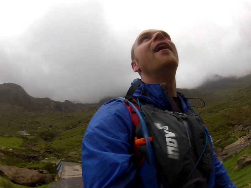
July 2012: At the summit of Snowdon at 5:00am after climbing it in the dark for an attempt at running the 3000s. I'd driven 170 miles and immediately climbed Snowdon with no time to rest before starting the run. This is not recommended.
Snowdon (Peak 1) to Garnedd Ugain (Peak 2)
Garnedd Ugain is just 900 meters from Snowdon and is very quick and easy to reach.
Garnedd Ugain (Peak 2) to Crib Goch (Peak 3)
Crib Goch is just 1.5km (less than a mile) from Garnedd Ugain but that distance includes climbing down the Pinnacles and scrambling across Crib Goch ridge which you will want to do quite slowly and carefully.
April 2015: Stood on Crib Goch (Peak 3) with Snowdon and Garnedd Ugain behind me.
Crib Goch (Peak 3) to Elidir Fawr (Peak 4)
It's a long way from Crib Goch to Elidr Fawr. First of all you have to get off Crib Goch. You do this by descending via the North Ridge.
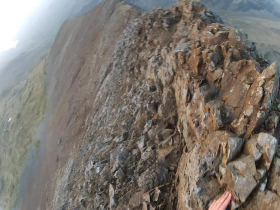
April 2015: Crib Goch's North ridge can be pretty daunting but then if you've not got a head for heights you probably shouldn't be doing the Welsh 3000s in the first place.
There are a few different ways to reach the path which is about a mile away, alongside the stream that leads to the A4086 but the most direct is by going down a steep, narrow gully. This is hard going so be careful.
July 2015: A photo taken from Crib Goch (Peak 3) looking at Elidir Fawr (Peak 4). As you can see, it's a really long way away with a hell of a lot of descent and ascent to keep things fun.
Once you're down on the A4086 then you've completed the Snowdon Group. It's then a 2.2km walk/jog to Nant Peris and then a 5.5km/3.4mile walk up Elidir Fawr.
July 2012: Arriving at the A4086 having completed the Snowdon Group. Only 22 miles to go...
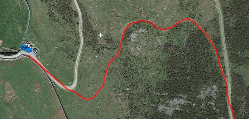
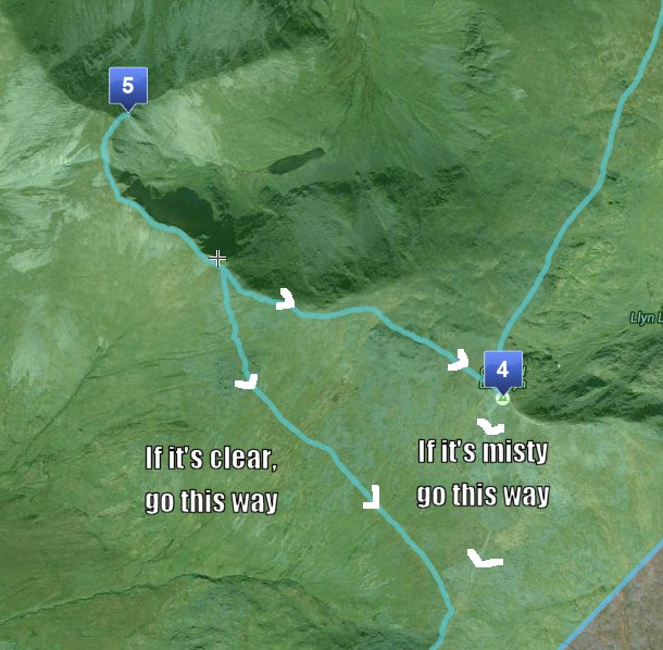
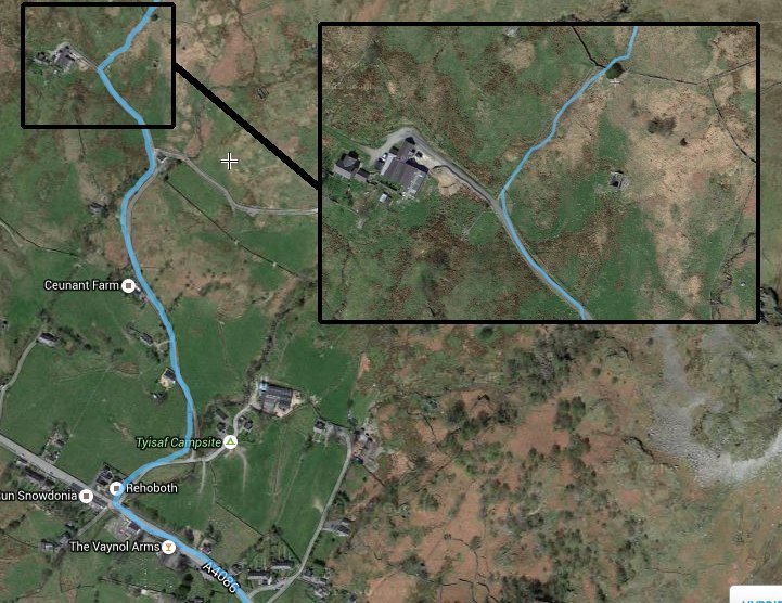
Here's a close up of the route from Nant Peris towards Elidir Fawr because it's not as obvious as you might think and I got lost around here the first time I tried the 3000s.
The two times I've climbed Elidir Fawr from Nant Peris I've not enjoyed it at all. It's a long, mundane hike and most of it is on a narrow grassy/scree path. It didn't help that both times I got lost near the bottom and both times I was also in mist which meant I had no mental stimulation from looking at the views. Fortunately when I did it from North to South I got to see some amazing sunset views from the summit.
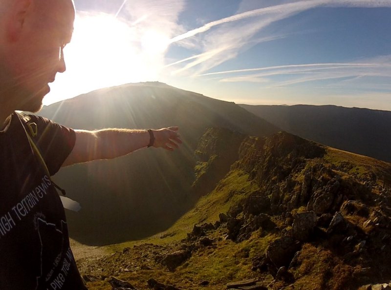
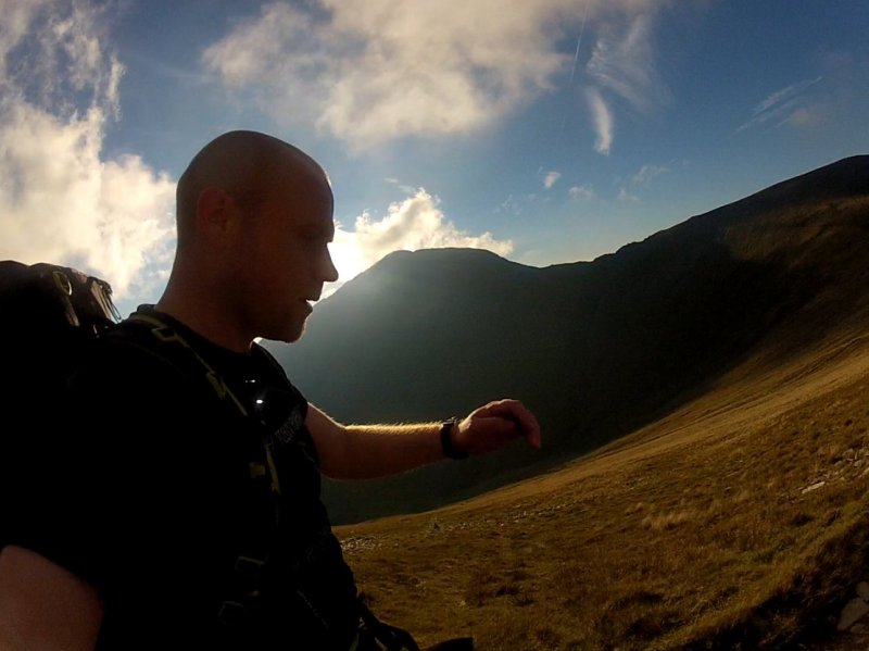
September 2015: Stood at the summit of Elidir Fawr (Peak 4), pointing at the Snowdon Group in the distance.
Elidir Fawr (Peak 4) to Y Garn (Peak 5)
Follow the Northern path down from Elidir Fawr which curves around the valley. Ignore the very steep Foel Goch because this isn't one of the 3000s. In 2012 I very stupidly didn't check my map and wasted a whole load of time and energy climbing it for absolutely no reason. Not my proudest moment, for sure. Instead just follow the path that goes around the right hand side of it. There is then a steepish climb up a scree path to Y Garn, which if it's a clear day, offers you some great views of nearly all of the 3000s at the summit.
July 2012: Jogging down Elidir Fawr (Peak 4) around the edge of the valley. See that steep mountain ahead? That's Foel Goch. Don't climb it.
Y Garn (Peak 5) to Glyder Fawr (Peak 6)
Coming down off Y Garn is very easy as it's just a long smooth slope. However, the scree slope of Glyder Fawr awaits you and it is a bit of a beast. All you can do is plod up it. I hope it's not misty so you have something to look at along the way otherwise it's very monotonous.
September 2015: Glyder Fawr (Peak 6) and its almighty scree slope.
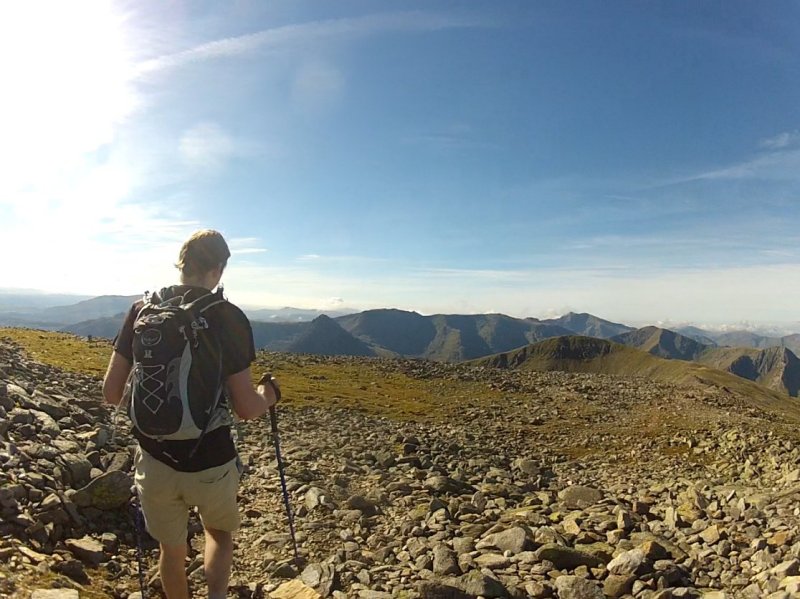
July 2012: On the Glyder Fawr plateau (Peak 6), facing the summit (the pile of rocks in the distance straight ahead).
Glyder Fawr (Peak 6) to Glyder Fach (Peak 7)
The distance between these two peaks is only about a mile but the path isn't particularly clear in places so if it's misty then you'll have to really be checking your compass a lot. It's also a bit of a plateau up there which is covered in piles of spiky rocks which means that it's not immediately clear where the summits of both mountains are, especially in mist.
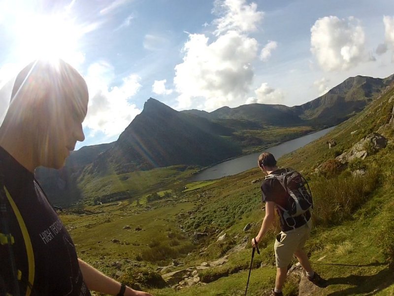
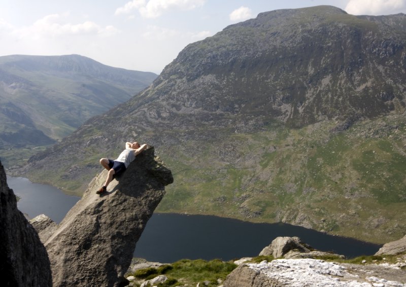
July 2012: From the summit of Glyder Fach (Peak 7), looking at Tryfan (Peak 8) in the middle and Pen Yr Ole Wen (Peak 9) to the left. The Cantilever Rock is in that pile on the right.
Glyder Fach (Peak 7) to Tryfan (Peak 8)
Shortly after leaving the summit of Glyder Fach you'll come across the famous Cantilever Rock where everyone gets a photo of themselves standing on it. Beyond that you reach the very steep slope leading down towards Tryfan. I'm not exaggerating when I say that it's very steep. It's also made of millions of loose rocks which can easily shift under your weight so be careful about going over on your ankle and also about anyone who's further down the slope than you are. On slopes like this it's very sensible to spread out a bit and climb down parallel to each other in case someone sets off a little rock slide. Even a stone smaller than your fist can get some real speed once it starts bouncing off of other rocks and taking one of those to the back of the head would really ruin your day.
September 2015: Close to the bottom of Glyder Fach's scree slope, looking at Tryfan's south side.
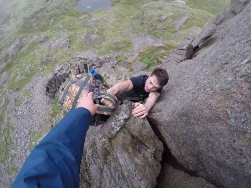
Once you're down the mega steep slope of Glyder Fach then you'll reach a wall on your left. There's a stile and a path which lead down to the left of Tryfan, to the visitors centre a couple of miles away. You don't want that. You want to follow the wall up the steep slope of Tryfan's south side. This involves a lot of scrambling and pulling yourself up large boulders. When you get to the top of Tryfan you'll see Adam and Eve, the two rocks right at the summit which you're supposed to jump between.
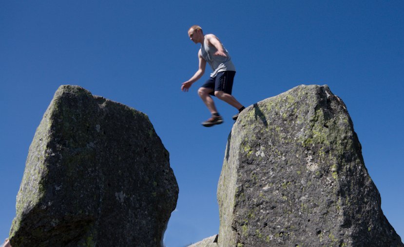
July 2010: Jumping between Adm and Eve.
Tryfan (Peak 8) to Pen Yr Ole Wen (Peak 9)
Now you have a HUGE descent and then a HUGE ascent to look forward to. The good news is that once you're at the top of Pen Yr Ole Wen you have got all of the toughest climbing out of the way. But the bad news is that you have to reach Pen Yr Ole Wen in the first place.
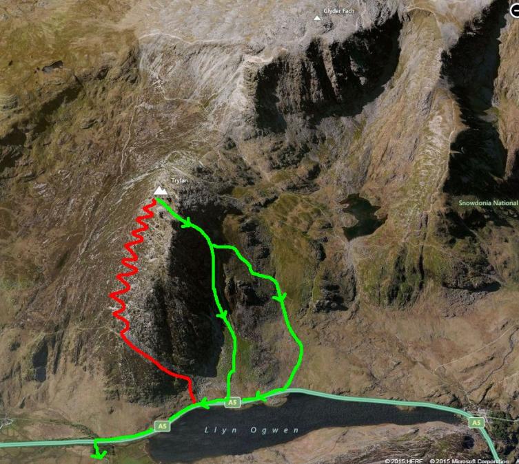
Rather than climb down Tryfan's North Ridge you should find the path to the West and go down that instead.
From the summit of Tryfan head down either of the green routes. The red route is the North Ridge and descending it would be very hard on your body.
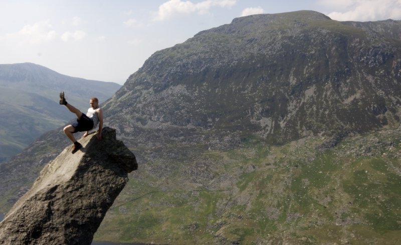
July 2010: Having a bit of a dance on Tryfan's Cannon rock, with Pen Yr Ole Wen (Peak 9) behind me. You won't pass this rock if you go down Tryfan's West path but I have added this photo anyway because it's funny.
When you finally get down to the A5 then it's a short walk East to the end of the lake where you walk up a track opposite the car park and head towards Pen Yr Ole Wen and its 670 meters of ascent. You follow a stream for most of the climb until the last third where it becomes a rocky scramble towards the West.
When you get to the summit you should congratulate yourself! If you're still feeling okay at this point then you should find the rest of the route to be a breeze!
September 2015: On the summit of Pen Yr Ole Wen (Peak 9) with Tryfan (Peak 8) in the background.
Pen Yr Ole Wen (Peak 9) to Carnedd Dafydd (Peak 10)
It's about a mile of gradual slopes between these two summits. Dead easy.
Carnedd Dafydd (Peak 10) to Yr Elen (Peak 11)
Follow the almost-flat ridge down from Carnedd Dafydd towards the East which then curves round to the North. The path is taking you to Carnedd Llewelyn (Peak 12) so you want to preferably break off to the North West and go more directly to Yr Elen. This will save you about 100 meters of ascent though it's a bit more tricky because there is no obvious path and it's along an awkward, steep slope. If it's misty then you may be better off just going to Carnedd Llwelyn and then descending down towards Yr Elen on the clearly marked path.
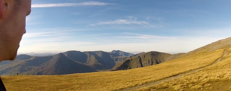
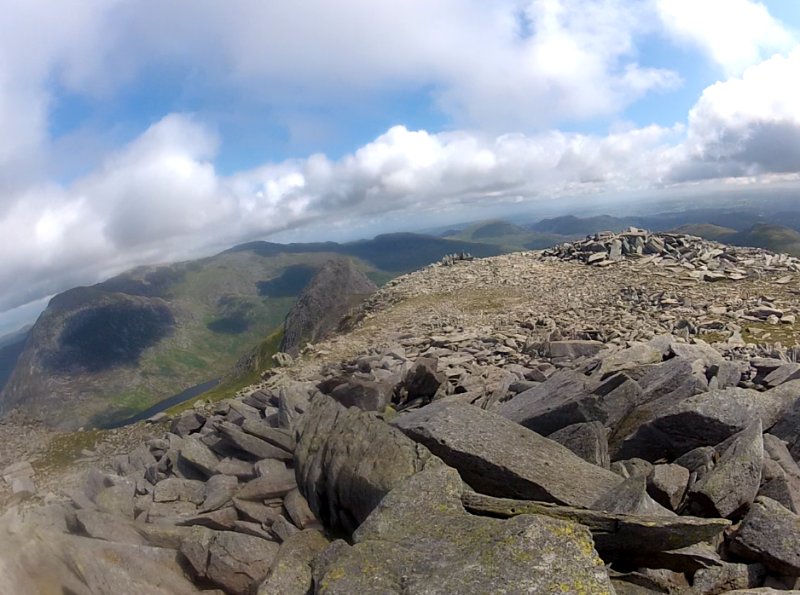
September 2015: Looking at Y Garn (Peak 11) on the left and Carnedd Llewelyn (Peak 12) in the middle.
Yr Elen (Peak 11) to Carnedd Llewelyn (Peak 12)
Follow the path up to Carnedd Llewelyn. It's only 1.3km/less than a mile.
September 2015: Yr Elen (Peak 11) behind me whilst looking at Carnedd Llewelyn (Peak 12).
Carnedd Llewelyn (Peak 12) to Foel Grach (Peak 13)
Now things really are easy (unless a storm has just blown in or you've broken your leg or something). The rest of the Carneddeu are basically just rolling hills with clearly marked paths between them. There's a bothy shelter at the base of the Foel Grach summit, just so you know.
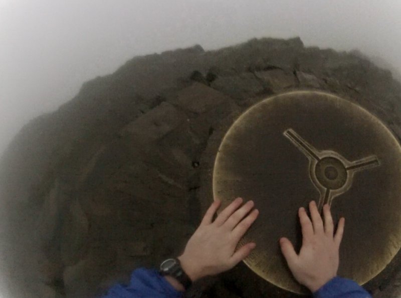
September 2015: At the summit of Foel Grach (Peak13).
Foel Grach (Peak 13) to Carnedd Gwenllian (Peak 14)
Easy peasy.
Carnedd Gwenllian (Peak 14) to Foel Fras (Peak 15)
Super simple easy peasy. Congratulations! You've just done the Welsh 3000s! Give yourself a pat on the back.
September 2015: At the summit of Foel Fras. The end of the Welsh 3000s! Except in this pic we're doing it North to South so we are in fact starting the Welsh 3000s with a very long day ahead of us.
Getting To The Car Park From Foel Fras
The best place to have a vehicle waiting for you is this car park right here. Follow the path North West for about 1km. To your left will be a valley (you won't be able to see it though because it'll be night time). You want to walk down into this valley towards the reservoir which is at the bottom. There's no real path but it's just grassy slopes (a bit marshy too) and pretty straightforward if you're following a compass.
Google Maps 3D is awesome! Here's a pic to show you how to get down to the reservoir from Foel Fras.
When you get to the reservoir you'll find a very clearly marked path to the North West of it which leads to and from the reservoir. Start walking this path for 3.5km/2.2 miles. When it splits into two paths as you're heading North make sure you take the one to the left. This is just 350m from the car park and (hopefully) your awaiting vehicle.
The Welsh 3000s are usually undertaken from South to North, starting on Snowdon and finishing on Foel Fras. However, you can of course do it North to South instead. The main reason why people don't do it this way around is that the Carneddau range is by far the easiest of the three ranges and so it is better to finish on them, when you are the most tired and it is probably dark. By doing the route North to South you finish on the Snowdon group which includes Crib Goch, arguably the most dangerous of all the 15 mountains (especially if you're tired and it's dark).
If you decide to do the Welsh 3000s from North to South then make sure you know exactly what you're getting into and make sure that you are very familiar with Snowdon and a range of routes up and down it.
Click here to open a map of the route in a new window (Note: the route in that link is actually for South to North but it's almost the same as North to South so it's okay for referencing stuff. It took me ages to make that map and I didn't feel like making a second almost-identical one at the time).
Getting Started
Drive to this car park. I'd recommend that you set off from this car park a couple of hours before sunrise.
Reaching Foel Fras, The First Peak
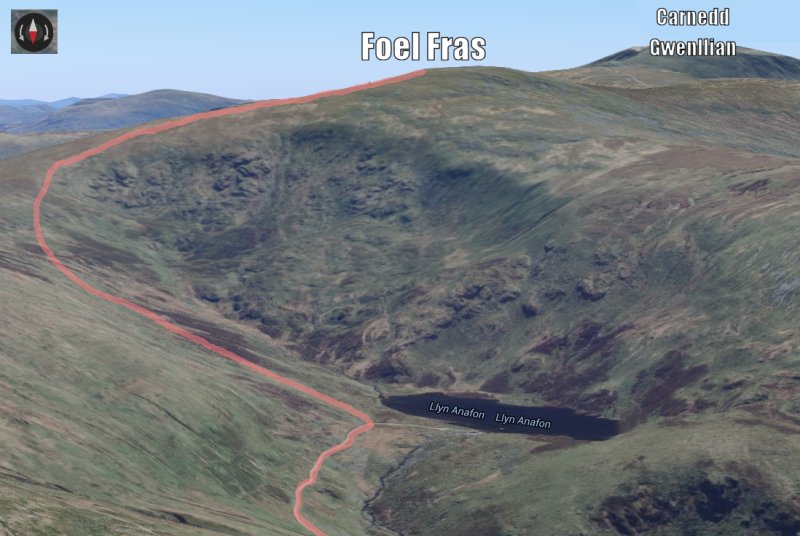
Set off from the car park and head up the winding North East path (not the North one).
The path leads you all the way to the Llyn Anafon reservoir. Once you get to this then head South East up the valley. There isn't a path. Well actually there might be a faint track somewhere or something, but I've only walked this once and it was in the dark so I didn't see it (and Google Maps doesn't show anything). Just walk up the hill South East until you reach the path at the top.

This path then takes you to Foel Fras which is the first peak of the Welsh 3000s and is part of the Carneddau range.
September 2015: Kev and I standing at Foel Fras summit after more than two hours of hiking up from the car park, about to start the Welsh 3000s.
Foel Fras (Peak 1) to Carnedd Gwenllian (Peak 2)
This is a very easy 1 mile hike. Some say that Carnedd Gwenllian isn't technically a 3000 peak (which is why the 3000s are sometimes called the 14 Peaks) but it's so close to the path you may as well touch the summit.
September 2015: Walking towards Carnedd Gwenllian (Peak 2). There's hardly any ascent or descent at this stage and it's very easy walking.
Carnedd Gwenllian (Peak 2) to Foel Grach (Peak 3)
Another very easy hike of less than a mile.
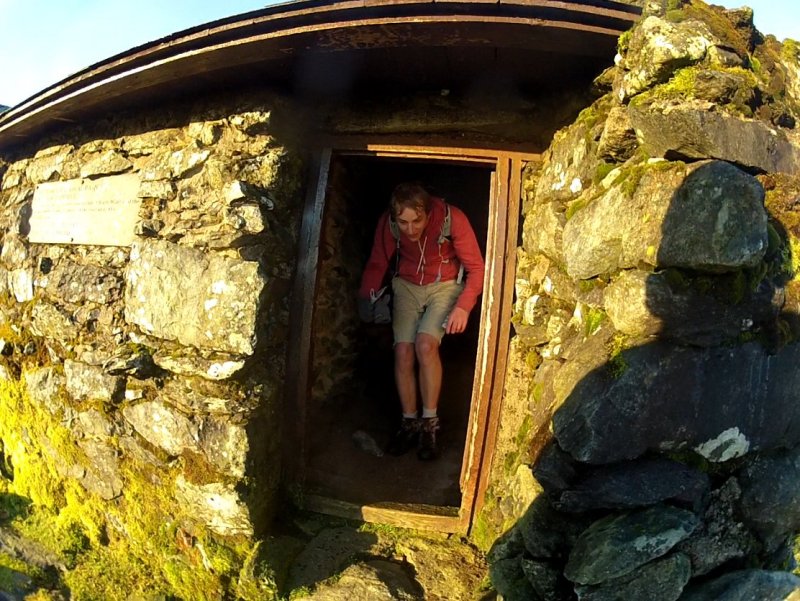
September 2015: Kev coming out the bothy next to the summit of Foel Grach (Peak 3).
Foel Grach (Peak 3) to Carnedd Llwelyn (Peak 4)
Another mile of hiking takes you to Carnedd Llwelyn, the Carneddau's highest peak. If it's a clear day then from this point you can see pretty much the rest of the 3000s and it's then you realise just what you've got up ahead of you!
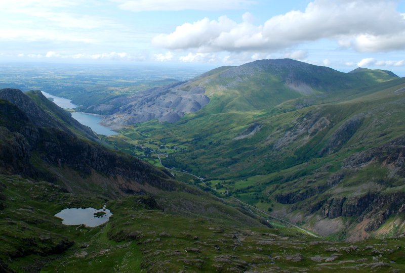
September 2015: Stood on the summit of Carnedd Llwelyn (Peak 4), looking at Carnedd Dafydd (Peak 6) and the Glyder range behind it.
Carnedd Llwelyn (Peak 4) to Yr Elen (Peak 5)
Yr Elen sticks out from the rest of the peaks, about a mile North West from Carnedd Llwelyn. There's a cool little ridge to walk alongside on the way over to it.
September 2015: Stood at the summit of Yr Elen (Peak 5) looking back at Carnedd Llwelyn (Peak 4) and the ridge that connects them.
Yr Elen (Peak 5) to Carnedd Dafydd (Peak 6)
If it's misty then it's recommended to go from Yr Elen back to Carnedd Llwelyn (peak 4) the same way that you came, and then follow the path from Carnedd Llwelyn towards Carnedd Dafydd. However, if it's clear then you can go directly from Yr Elen to the path between Carnedd Llwelyn and the ridge leading to Carnedd Dafydd. This is along narrow, awkwardly sloped sheep tracks (it would be easy to go the wrong way in fog) but it saves you climbing about 100m back up Carnedd Llwelyn only to immediately come down again.
Once up on the ridge leading to Carnedd Dafydd it's an easy, gradual slope of about a mile to the summit.

September 2015: Walking along the very easy path towards Carnedd Dafydd (Peak 6), looking at Tryfan (Peak 8) and the Glyders awaiting us.
Carnedd Dafydd (Peak 6) to Pen Yr Ole Wen (Peak 7)
This is a very easy mile or so of gentle slopes. From the summit of Pen Yr Ole Wen you can see Tryfan, the Glyders and Snowdon. It is then clear that the real mountains, ascents, descents, scrambles and scree are about to begin. So far you've had it easy. Now for the real stuff!
September 2015: Coming off the summit of Carnedd Dafydd (Peak 6), heading towards Pen Yr Ole Wen (Peak 7).
Pen Yr Ole Wen (Peak 7) to Tryfan (Peak 8)
Pen Yr Ole Wen is a big mountain and you have to climb down the whole damn thing to get to Tryfan. That's about 670m of descent spread over 2 miles. The whole time you're coming down Pen Yr Ole Wen you can see Tryfan and the Glyders looming in the distance.
September 2015: Descending the huge slope of Pen Yr Ole Wen (Peak 7) towards Tryfan (Peak 8).
Once you get down to the A5 you have officially completed the Carneddau range! It's then a short walk along the road before getting straight back into it and climbing Tryfan's very steep North ridge. This is basically just one long scramble with 600m of ascent. There's not really a set path for this, you just climb whatever is in front of you until you reach the top.
September 2015: Kev looking down at the A5 from about a third of the way up Tryfan (Peak 8).
July 2010: Life sure can be tough sometimes. On Tryfan's (Peak 8) Cannon rock with Pen Yr Ole Wen (Peak 7) behind me.
Once you get to the top you'll see Adam and Eve, the summit rocks which you have to climb up on and jump between (it's the rules).
September 2015: Stood on Adam, about to jump to Eve.
Tryfan (Peak 8) to Glyder Fach (Peak 9)
The descent down Tryfan's south ridge is steep but not as far as its North ridge. If it's clear then the whole time you'll be looking at Glyder Fach and its massive, steep slope of scree which you then have to climb. Between Tryfan and Glyder Fach is a wall on your right. This is useful if you're a bit unfamiliar with the route and if it's misty because you can follow it towards Glyder Fach (and don't cross the wall and follow the path West as that's completely the wrong direction).
Almost every rock on the Glyder Fach slope is loose so you have to be extra careful of making them roll. If you're climbing with other people then you should spread out a bit so that if someone starts a mini landslide then there's no one behind them to get hit by a rock.
Once you've got to the top of the slope it's a short walk across the plateau to the summit. The famous cantilever rock is along the way which makes for another good photo opportunity.
September 2015: Climbing up the steep scree slope of Glyder Fach (Peak 9).
Glyder Fach (Peak 9) to Glyder Fawr (Peak 10)
The walk between these two peaks is relatively easy; just 1 mile with barely any ascent or descent. The ground is really rough though. From Glyder Fawr you can now see Snowdon up close and personal to the South West. However you still have several big climbs to do before that.

September 2015: Approaching the summit of Glyder Fawr (Peak 10) in the distance.
Glyder Fawr (Peak 10) to Y Garn (Peak 11)
The descent off of Glyder Fawr is pretty brutal but not nearly as bad as having to climb up it if you're doing the Welsh 3000s from South to North. It's really steep and basically just a trench cut into the dirt. I imagine that when it rains the path becomes 10x more awkward in either direction.
September 2015: Looking back at Glyder Fawr (Peak 10) after descending its massive trench path.
Once you're down off of Glyder Fawr then you pass a little lake and start the long but easy climb up to Y Garn. Once at the summit you have a great view of all of the 3000s except for the earliest peaks.
September 2015: Stood on the summit of Y Garn (Peak 11) with Pen Yr Ole Wen (Peak 7), Tryfan (Peak 8) and Glyder Fach (Peak 9) in the background.
Y Garn (Peak 11) to Elidir Fawr (Peak 12)
It's a pleasant walk down from Y Garn and easy to jog if you're wanting to speed things up a bit. The previous Glyders have been piles of rocks, boulders and scree but now the Glyders are grassy and smooth. It's over 2 miles from Y Garn to Elidir Fawr. Ignore the mountain Foel Goch. It's not one of the 3000s (something which I forgot to check in my 2012 attempt causing me to waste a load of energy and time climbing its very steep Northern slope).
The path leads around the edge of a really cool valley with Elidir Fawr towering above to the West. The path is easy until about half way up Elidir Fawr when it becomes steep. There's also a false summit which could be a kick to the teeth if you're feeling tired by this point.
September 2015: Walking around the valley towards Elidir Fawr (Peak 12) in the background.
Elidir Fawr (Peak 12) to Nant Peris (a village in the valley)
Elidir Fawr is a big mountain and both climbing and descending it are real slogs. The path is pretty straightforward as long as you find it near the start. Just head directly South from the summit and you should hit it after 50 meters or so. It then goes South West down the mountain, crosses a little bridge and becomes a proper path which takes you all the way down, past some houses, and to the camp site.
September 2015: Descending Elidir Fawr's very steep grassy slopes. Note: We missed the path and instead just went straight down into the valley.
I'm including a close up of the route into Nant Peris because it's not as obvious as you might think.
Nant Peris
Once you get off of the massive Elidir Fawr you find yourself in the village of Nant Peris. The path passes by the Nant Peris camp site which has an outdoor tap if you need to resupply with water. There are also toilets.
Now that you're in Nant Peris you've officially finished the Glyder Range and have only the Snowdon Group to do. I say "only" but it's not just some quick little jaunt. The Snowdon Group might have the lowest number of peaks (3) but it's really big. After all, Snowdon is the highest mountain in England and Wales! Also if you've done Snowdon before you probably started at Pen-y-pas which is 220m higher up than Nant Peris so you have that much extra ascent to cover compared to what you're used to.
Tackling The Snowdon Group
When deciding how best to bag the Snowdon Group it becomes much more obvious why the Welsh 3000s are usually done from South to North. Finishing on the Snowdon Group brings up a number of logistical concerns when you consider that by the time you reach it you'll be very tired and it'll almost certainly be night time.
On the map below I've marked the different ways you can go up and down Snowdon from Nant Peris (the green pin), getting each of the three peaks (1: Snowdon, 2: Garnedd Ugain, 3: Crib Goch) along the way and finishing back on the A4086 at the yellow pins where you will have parked your car or from where you can be collected.
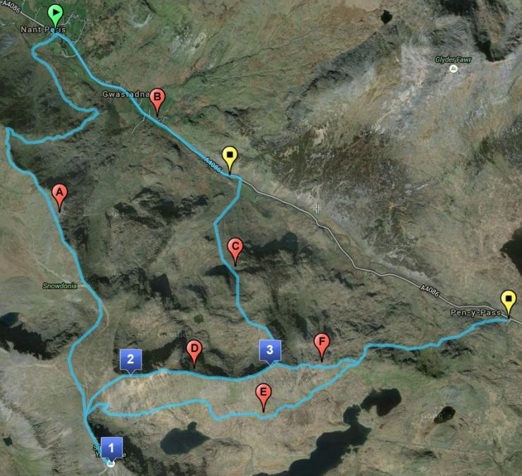
Ascending the Snowdon Group
To get up to the peaks you basically have two options.
Route A: This involves a hard slog up a steep grassy slope to then reach the railways and follow it up to the summit of Snowdon. Kev and I did this one in September 2015. It felt like it went on forever. I'm sure it's easier on a nice day when it's not windy or misty but that night it seemed to be never-ending. We also got partially lost on the slope leading up and basically decided to just climb up until we reach something because there was no path for most of it.
Route B: For this route you just walk up the A4086 until you get to the path that leads up onto Crib Goch. It's a steep climb up and you then have two options, either going up route C to Crib Goch's North ridge, or route D which takes you to the connecting point between Crib Goch (3) and Garnedd Ugain (2). Route C means that you don't go back on yourself but it has some grade 1 scrambling which you don't have to do on route D. I think I'd recommend D over C for this very reason. Of course, both routes still involve climbing across Crib Goch ridge so you can't avoid that.
Descending the Snowdon Group
There are three main options for getting down off of Snowdon Group. Of course, the route you take will depend on which way you came up and where your car is waiting.
Route A: If you came up via Crib Goch (3) and have tagged it and Garnedd Ugain (2) then once you get to Snowdon (1) and have completed the Welsh 3000s then you can opt for a long but straightforward descent down the Llanberis Path into Llanberis. You could also head down the Eastern slope to Nant Peris as marked on the map, but this would be a fair bit more complicated and difficult in the dark compared to just walking down by the railway.
Route G: Similarly, if Snowdon was your final peak then you could descend via the Pyg Track (G). This takes you to Pen-y-pas car park.
Route E: If you came up Route A to Snowdon then you still have to tag Garnedd Ugain (2) and Crib Goch (3). This means that you complete the Welsh 3000s near to the most Eastern point of Crib Goch. From here you have two routes down; either Route C down the North ridge, or Route F, down Crib Goch's Eastern side and onto the Pyg Track to Pen-y-pas. Both C and F are difficult descents but I'd say that C is a fair bit more risky.
Important Advice: Whichever route you choose make sure that you're very familiar with it beforehand. As I keep on saying, by the time you're on Snowdon you'll be extremely tired, it'll be the middle of the night and the weather could be really bad (even if the report said it wouldn't be). Given these circumstances there really isn't an easy way to do the Snowdon Group. Just make sure you're really careful and have LOTS of torch light. I have first hand experience with seeing just how tough Snowdon can be at the end of a hard day's hiking the Welsh 3000s. It's not fun and you're constantly just one stumble away from injury or worse.
Alternatively just do the 3000s from South to North. The Snowdon Group is much more straightforward that way.

July 2012: Crib Goch Ridge. Would you want to be up here in the pitch black, in high winds and exhausted from nearly 30 miles of hiking? Probably not.
And that's the end of my guide to the Welsh 3000s! I hope you liked it. Let me know if you think I've missed anything or if you spotted any errors. Thanks!
All of the information and advice given on the previous pages of this guide can be summarised in one sentence:
Plan properly and be fit.
There. Simple. Don't say I didn't warn you!
Let me save you 10 seconds of Googling and suggest to you two good websites for finding out more info about the Welsh 3000s and about doing the 15 Peaks challenge.
• 14Peaks.com
This is probably the best site out there for 3000s info and it includes a lot of articles written by people who have done the challenge as well as detailed info about each of the summits.
• Welsh3000s.co.uk
This website is the one I used to plot the route in 2011 when I was researching how to do the 3000s. However, the images on the site are very small and the route descriptions aren't particularly clear in places (which led to me getting lost at the base of Elidir Fawr on my first attempt though that was completely my fault and I'm not blaming the website at all).
If you have spotted any errors in my guide or you think that you can improve on something that I've suggested then contact me using the form below and let me know so that I can make amendments.
Thanks!
Plan properly and be fit.
There. Simple. Don't say I didn't warn you!
Websites For More Info About The Welsh 3000s
Let me save you 10 seconds of Googling and suggest to you two good websites for finding out more info about the Welsh 3000s and about doing the 15 Peaks challenge.
• 14Peaks.com
This is probably the best site out there for 3000s info and it includes a lot of articles written by people who have done the challenge as well as detailed info about each of the summits.
• Welsh3000s.co.uk
This website is the one I used to plot the route in 2011 when I was researching how to do the 3000s. However, the images on the site are very small and the route descriptions aren't particularly clear in places (which led to me getting lost at the base of Elidir Fawr on my first attempt though that was completely my fault and I'm not blaming the website at all).
A Work In Progress: Feel Free To Help Out!
If you have spotted any errors in my guide or you think that you can improve on something that I've suggested then contact me using the form below and let me know so that I can make amendments.
Thanks!